History
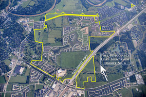
The District is a political subdivision of the State of Texas, created by order of the Fort Bend County Commissioners Court, adopted on July 2, 1984, and operates pursuant to Chapters 49 and 57 of the Texas Water Code. The District currently contains approximately 1,522 acres of land.
The District is located approximately 30 miles southwest of the central downtown business district of the City of Houston and primarily within the extraterritorial jurisdiction (“ETJ”) of the City of Richmond, with a small portion of undeveloped land within the ETJ of the City of Sugar Land. The District is also located within the boundaries of the Lamar Consolidated Independent School District. Access to the District is provided by U.S. Highway 59 to Richmond Parkway.
The District was created to construct and operate levee and drainage improvements to serve the land within the boundaries of the District.
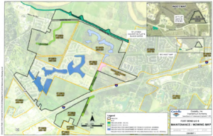
The developer of approximately 520 acres of the land within the District is CW Richmond LP, a Texas limited partnership (“CW Richmond”) with Caldwell Companies, Houston, Texas as the general partner. CW Richmond was formed for the sole purpose of developing its land within the District, which land is also within MUD 187. The George Foundation, a charitable trust established in 1945, owns approximately 298 acres of land within the District. Approximately 296 acres of land is also within MUD 207. MUD 207 includes an additional approximately 2 acres not within the District boundaries. HW 589 Holdings LLC, a Delaware limited liability company (“HW 589”), owns approximately 589 acres of land within the District, which is also within MUD 215. HW589 is a Delaware limited liability company formed to develop land within MUD 215. HW 589 is managed by an affiliate of The Johnson Development Corp.
As of August 1, 2017, 2,064 single-family residential lots on approximately 642 acres had been completed, 1,120 homes were completed (1,108 occupied), 181 homes were under construction or in a builder’s name and 763 vacant developed lots were available for home construction. A portion of the District (MUD 187) is being developed as Del Webb Sweetgrass, an active adult/retirement community with home ownership restricted to purchasers age 55 or older with additional restrictions on children living in the home. Del Webb is a trademark community of Pulte Homes. Portions of the District are being developed as Veranda (MUD 215) and Williams Ranch (Williams Ranch MUD), both single-family residential communities, and approximately 18 acres are being developed for commercial use where an HEB Grocery is under construction (MUD 207) with an expected opening in the first quarter of 2018. Approximately 605 additional developable acres within the District (located in MUD 207, MUD 215 and Williams Ranch MUD) have not been fully provided with water distribution, wastewater collection and storm drainage facilities and approximately 257 acres are not developable (earthen levee, rights-of-way, detention, open spaces, easements and utility sites) of which 43 acres are not located within any municipal utility district, but are located within the boundaries of the District.


